Cities and mountains of the north
Itinerary Scores
Description
The itinerary will take you to towns and roads in the North Eastern part of Gran Canaria, between history and nature. A journey crossing the mountainous heart of the island, between curves that open onto surprising panoramas and small villages suspended in time. Houses with wooden balconies overlook quiet squares, and the views sweep across deep valleys and volcanic profiles that tell the story of nature's power. An invitation to calm, to savour the slow rhythm of rural life. It's a route that combines the authenticity of the villages with the grandeur of the landscape, leaving the impression of having discovered the truest essence of the island. Recommended only if purchased as part of a tour with other itineraries. Departure and arrival in Las Palmas.
What is included
- A PDF with a detailed map, a list of stops, timelines, a complete description of the route, points of interest, and recommended restaurants.
- A GPX track with all the stops, which can be used with your favorite app.
Included Points of Interest
Basílica de la Virgen del Pino
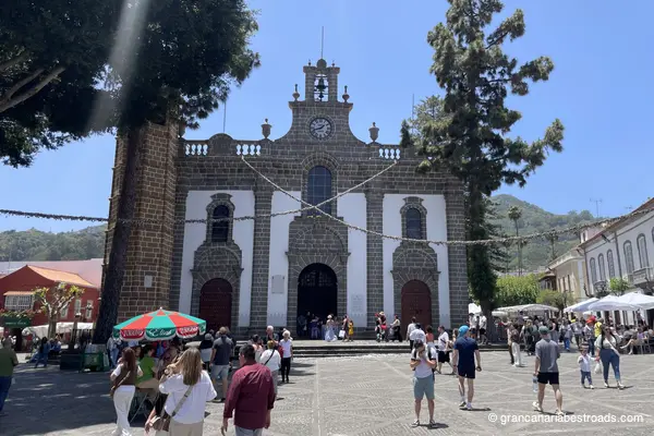
It is one of the most religiously important churches in the Canary Islands. The **Basílica de Nuestra Señora del Pino** stands in the heart of Teror's cobbled old town. The venerated image of the Virgin is kept in a silver canopy in the Camarín — a treasure chamber holding centuries of devotional gifts, jewels, ex-votos and the **Green Cross** carved from the wood of the original pine. The sculptural works inside by José Luján Pérez, the leading island artist of the 18th century, are utterly captivating and well worth a visit. The basilica is the centerpiece of a town that is one of the finest examples of traditional Canarian architecture — whitewashed facades and intricately carved wooden balconies line the main streets around the square. On Sunday mornings a market fills the square with local cheeses, mojo sauces and traditional produce among the best on the island.
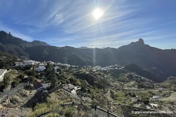
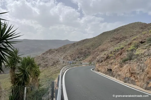
Artenara
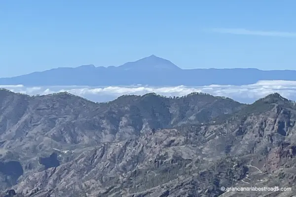
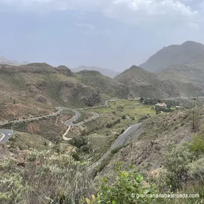
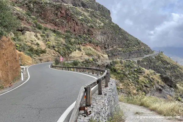
Artenara repays the time spent getting there with one of the most beautiful views in the entire Canary archipelago. From the rim of the **caldera** at 1,270 metres, Roque Nublo rises in the distance, and on clear days you can see the cone of the Teide and the island of Tenerife on the horizon. The village itself is quiet and authentic — cave houses carved into the volcanic tuff, narrow alleys, and a handful of local restaurants serving Canarian cuisine and a goat cheese that is highly renowned and the winner of several contests. Don't miss the Chapel of the Virgen de la Cuevita, a small church set into a natural cave at the edge of the caldera, with the ravine opening up beneath your feet. The nearby Risco Caído archaeological complex is a **UNESCO World Heritage** site. Also very distinctive is the restaurant **Cueva Del Molino**, where you dine inside the rock: an experience that alone is worth the visit. Every road leading up to Artenara is a true driving pleasure: long sequences of hairpin bends among pines and eucalyptus with little traffic and open panoramas. The **GC-220** from Agaete, the **GC-210** from Tejeda and the **GC-21** straight from Las Palmas are all exceptional. Temperatures at altitude are noticeably cooler than on the coast — a welcome change on hot days.
Arucas
Arucas is famous above all for its church: the neo-Gothic **Iglesia de San Juan Bautista**, built from dark volcanic basalt over the course of decades and nicknamed the Cathedral of Arucas for good reason. Its soaring towers are visible from miles away. The interior houses Italian sculptures, Flemish paintings, and stained-glass windows from Paris — it's absolutely worth setting aside a long visit. The town center around the church is a pleasure, with covered markets, shops, and characterful restaurants. Another renowned destination is the Arehucas rum distillery, which has been producing rum since 1884: it offers guided tours and a tasting room. It pairs naturally with a stroll through the banana plantations you'll see along the roads heading inland. The botanical garden of the Marquesa de Arucas adds a leafy detour on the edge of town. Arucas makes an excellent first stop on a northern loop — well connected by road, with good fuel and services. Arrive via the **GC-330** from Firgas for a more scenic approach through the green ravines, or use it as a launch point before climbing inland along the long and beautiful **GC-21**.
Iglesia de San Juan Bautista
This is the church that defines Arucas. Built entirely from local dark grey-blue basalt over nearly seventy years, its two pointed towers dominate the town's skyline from every approach road. The interior comes as a complete surprise — three long naves, elaborate stained-glass windows by the Parisian Maumejean that cast coloured light across the stone, and a 16th-century crucifix on the main altar. Give it fifteen minutes; the transition from the sun-dazzled square to the cool, cathedral-like nave is striking. The baptismal chapel holds a finely carved blue stone font. The square outside is ringed with local cafés and restaurants — a good spot for a coffee after your visit. The famous Arehucas rum distillery is a short walk away and offers tastings. This is a natural fuel-and-coffee stop on the north coast route — the church is unmistakable from the main road. Park in the square, take a short stroll around the centre, and use Arucas as a launching point before the roads begin to climb inland.
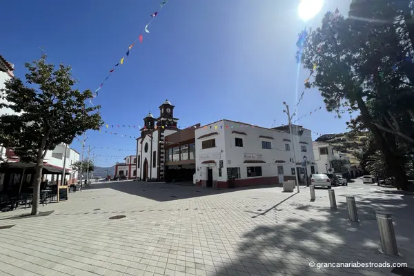
Firgas
«Firgas is worth the visit for the **Paseo de Gran Canaria** alone, a tiled pedestrian walkway descending through the center of town with ceramic bas-reliefs depicting each island of the archipelago and water running along carved stone channels at your feet. A thirty-meter waterfall, surrounded by subtropical vegetation. It is one of the most unusual and photogenic public spaces on the island. The views north toward the Atlantic from the riverside walk are lovely and distinctive, which is where the nickname "balcony of the Atlantic" comes from. The parish church of San Roque sits on the main square, simple and intimate. The town is compact: you can walk the whole of it in twenty minutes. A bar on the square is the natural stop for a coffee. The access roads from Arucas or Teror wind between banana plantations and pine-scented hills, with little traffic and reasonably good asphalt, but they are short and not very stimulating. Firgas is an easy stop to add to a circuit in the north, and far less frequented than Teror or Arucas — quieter, with a more authentic, local atmosphere. A stop more for the pleasure of discovery than for the pleasure of riding»
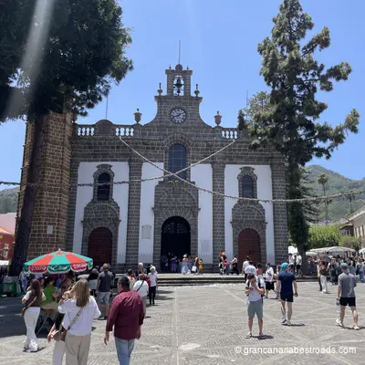
Teror
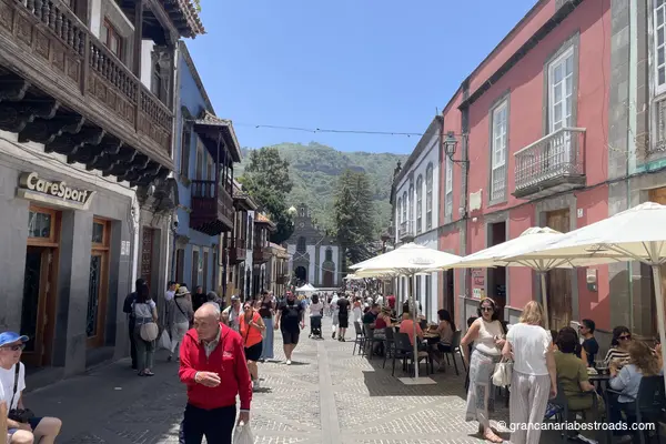
The historic centre of **Teror** is one of the finest examples of traditional Canarian architecture on any of the islands. The **Calle Real de la Plaza** is lined with whitewashed facades and richly carved wooden balconies, each one different from the next, which together form one of the most photographed urban views on **Gran Canaria**. The **Basílica de Nuestra Señora del Pino**, the most important church on **Gran Canaria**, dominates the square with its warm yellow cantería facade and its Portuguese Gothic-style bell tower. Inside the basilica, important sculptural works by José Luján Pérez and the treasure room with centuries of votive offerings are absolutely outstanding. On Sunday mornings a market fills the plaza with local cheeses, mojo sauces and traditional products — among the best on the island. The mineral water from **Teror** is sold everywhere on the island; it is genuinely good. The town feels completely separate from the capital despite the short distance. You reach it through hills cloaked in pine forest along the **GC-21** or the **GC-43**. You can easily park near the town centre. Allow at least an hour: the basilica, the historic streets and a coffee on the square make this the most rewarding cultural stop among the towns of northern Gran Canaria.
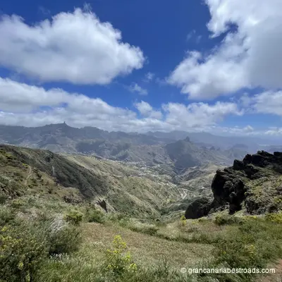
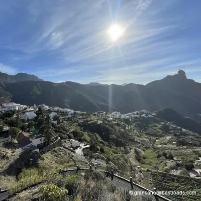
Tejeda
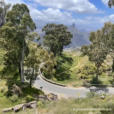
**Tejeda** is the beating heart of the most beautiful roads on **Gran Canaria**. The village sits at around 1,050 metres in the ancient caldera, surrounded by almond orchards that burst into pink and white blossom every February. The **Fiesta del Almendro en Flor** transforms the valley for the whole weekend. The village square is small, authentic and well equipped: at any time of year the local craft shops sell marzipan, honey and almond products, and there are cafés for a stop with a view over the caldera. **Roque Nublo** and **Roque Bentayga** are both visible from the surrounding roads. The **Parador** at **Cruz de Tejeda**, a few kilometres above the village, offers a bar and eatery with one of the finest panoramas on the island. The local almond sweets are among the best on Gran Canaria: well worth buying. From whichever direction you come, **Tejeda** is probably the high point of the route: from **Maspalomas** to the south, from **Agaete** to the north-west or from **Las Palmas** to the north-east, the roads serve up spectacular climbing sequences of consistent quality. The village is the natural midpoint of any serious loop through the interior, so plan your route to pass through it rather than around it.

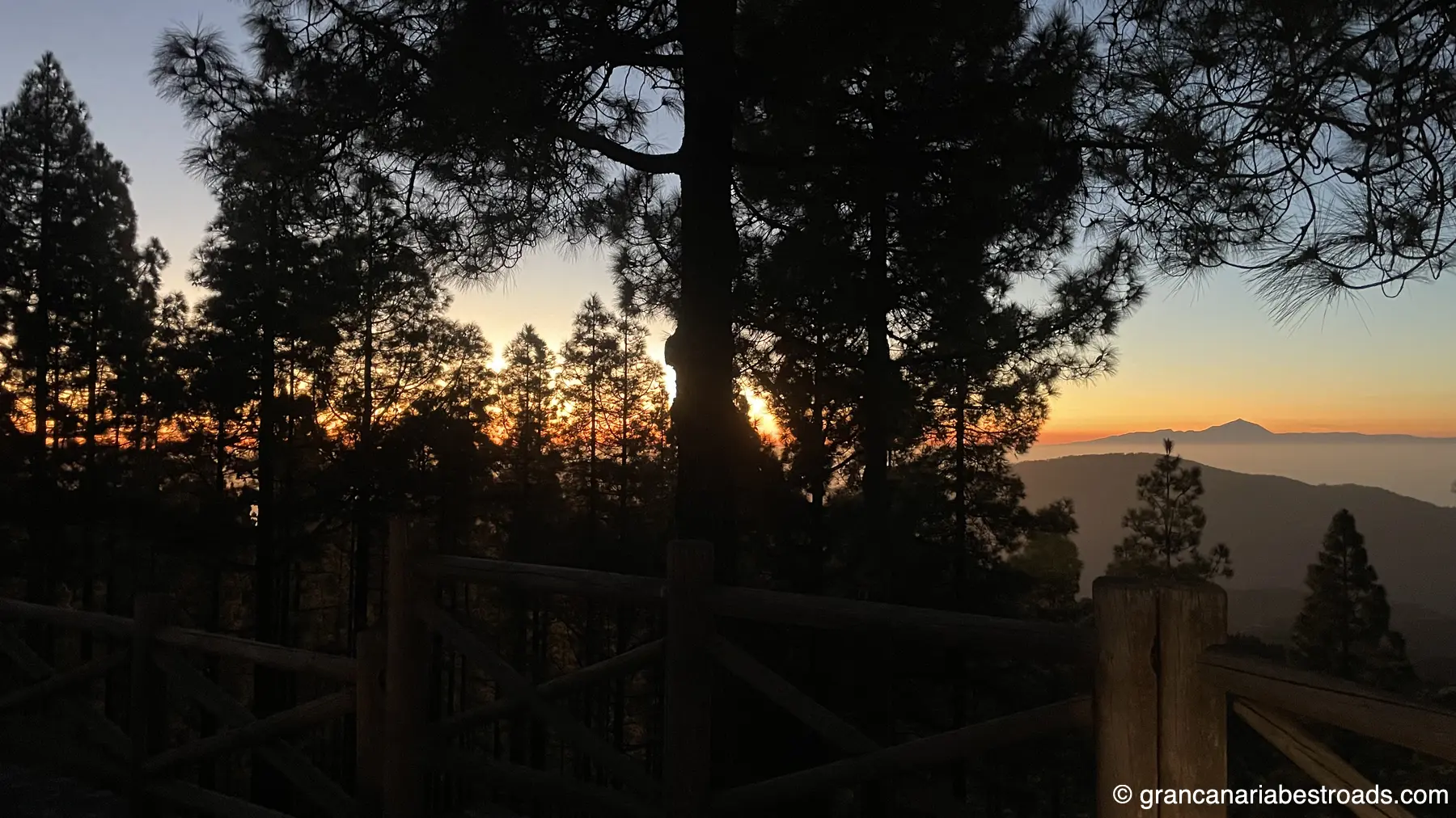
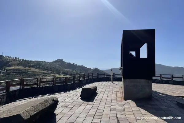
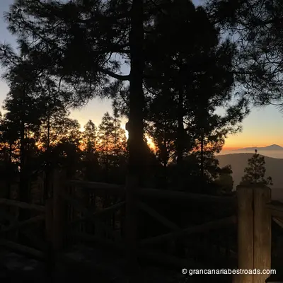
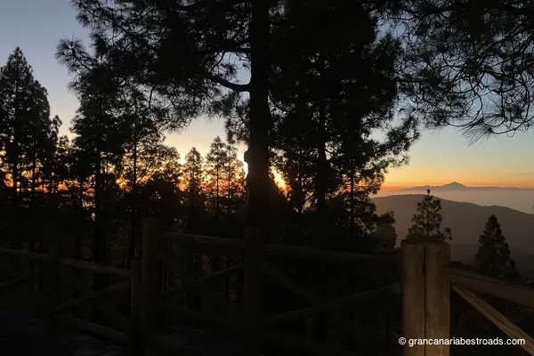
Mirador astronómico de Pinos
Built specifically for astronomical observation at around 1,400 metres of elevation, the **Mirador Astronómico de Pinos** is equipped with orientation panels and a sheltered viewing platform that minimises light pollution. On clear nights the Milky Way is extraordinary — the altitude, the clean Atlantic air, and the distance from the coastal resort lights make this one of the best stargazing spots on **Gran Canaria**. By day, the views over the pine canopy down to the ocean are exceptional, with **Tenerife** and **Teide** visible on the horizon. The surrounding **Tamadaba** pine forest is fragrant and atmospheric, and the walk around the site is rewarding even without a telescope. Plan this as a late-afternoon stop: linger until sunset, when the temperature drops, and stay for the stars before descending towards the coast. The road through the **Tamadaba** forest has tight bends, fresh air, and sudden openings with coastal panoramas. One of the few roads with excellent driving pleasure in both directions: find a way to include this stop on your travels.
Cruz de Tejeda
The geographic and, for some, emotional heart of **Gran Canaria**. At around 1,450 metres above sea level and perched on the rim of a caldera, **Cruz de Tejeda** sits at the crossroads of several of the island's mountain roads, all of them spectacular, with **Roque Nublo** rising up before you and the panorama opening out in every direction. The stone cross at its centre is surrounded by craft stalls selling almond-based products from the orchards below: every February the almonds blossom white and pink in one of the island's most celebrated natural events. The *Parador* at the mouth of the pass is an elegant traditional stone building where you can stop for a coffee or a meal with views over the caldera. Along the road you'll often find stalls selling almond sweets, honey and local products among the finest on the island. Cloud formations frequently wrap around the rim of the caldera, creating a dramatic, ever-changing light that is well worth waiting for. **Cruz de Tejeda** is the natural climax of any ride through the interior. The **GC-150** arrives both from the North, through a pine forest, and from the South, from **Pico de las Nieves**; the **GC-60** comes in from the West and climbs all the way from **Maspalomas**, passing through **Tejeda** with tight hairpins and dizzying drops, and the **GC-15** is the connecting point for all the roads climbing up from the East.
Mirador De La Atalaya de Artenara
The finest view from Artenara — and Artenara has several remarkable ones. From the edge of the village at 1,270 metres, the great caldera opens up before you: Roque Nublo rises in the foreground, Roque Bentayga off to one side, and on clear days the snow-capped cone of Teide on Tenerife appears on the horizon. Every road up to Artenara is a genuine riding pleasure: long sequences of hairpins through pine and eucalyptus with little traffic and wide-open views. Plan your descent along a different route, towards the Tamadaba forest or Agaete, rather than doubling back the way you came: you'll never be disappointed!
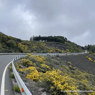
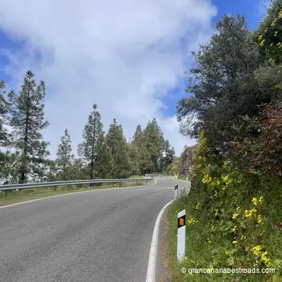
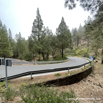
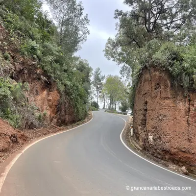
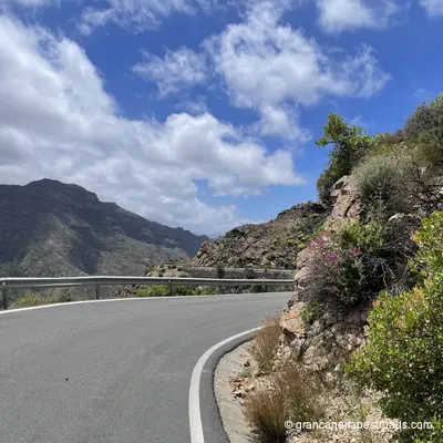
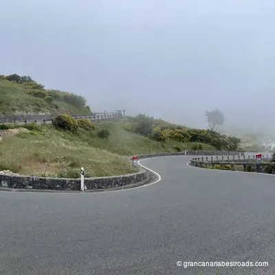
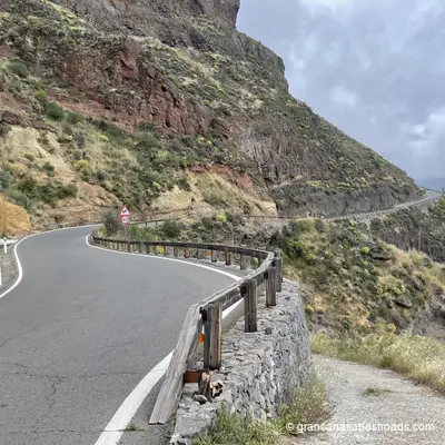
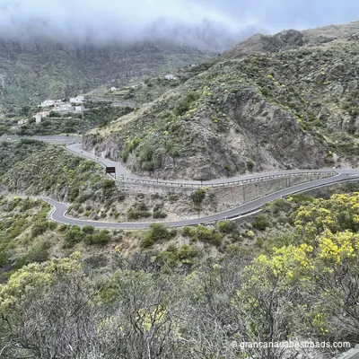
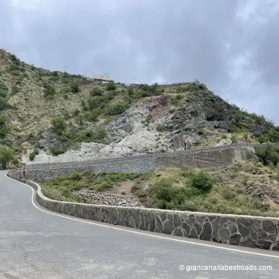
Gallery
Journeys that include this itinerary
Get more value with a complete journey package
Gran Canaria Journey in 3 Days
A 3-day journey to discover every face of Gran Canaria, from the wild coast to the volcanic peaks and the most authentic villages on the island.
Included itineraries:
- Eastern mountains
- Cities and mountains of the north
- I want to go to the sea
Gran Canaria Journey in 4 Days
A 4-day journey to discover Gran Canaria, from the wild coast to the volcanic peaks, the most authentic villages, and the island's main natural park.
Included itineraries:
- Eastern mountains
- Western Mountains
- Cities and mountains of the north
- I want to go to the sea