Gran Canaria Journey in 2 Days (road version)
Description
From the coast to the peaks, this journey will take you to discover the best of Gran Canaria in all its forms.
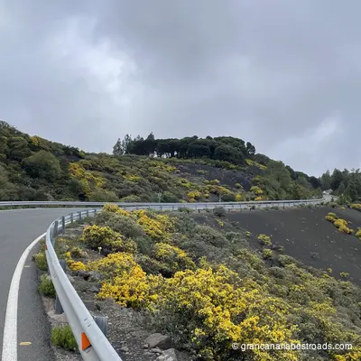
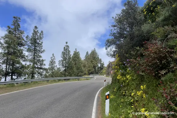
Along the coastal route you will ride the entire shoreline of the island, past desert dunes, picturesque towns, and a legendary road perched above the ocean for miles. A breathtaking Mirador awaits you — one you will never forget — while carefully chosen detours let you savour some of the most beautiful and fun roads on the island.
Moving inland, you will climb to Gran Canaria's most famous summits, Pico de las Nieves and the legendary Roque Nublo, guided through the finest mountain scenery where sweeping sea views alternate with vegetation that changes at every bend. The route also takes you through the fascinating Barranco de Moya, out and back, along what are the most scenic and thrilling roads on the entire island. And get ready for a sunset that will leave you breathless.
A slightly demanding journey for those who prefer to ride more and walk less.
Departure and arrival in Las Palmas.
What is included
- A PDF with a detailed map, a list of stops, timelines, a complete description of the route, points of interest, and recommended restaurants.
- A GPX track with all the stops, which can be used with your favorite app.
Included Itineraries
Grand sea itinerary
An itinerary along the coasts, the most famous miradors and some beautiful, thrilling roads of Gran Canaria.
The heart of Gran Canaria (road version)
Discover the peaks and towns at the heart of Gran Canaria, prioritising the riding experience.
Included Points of Interest
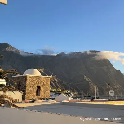
Puerto de las Nieves
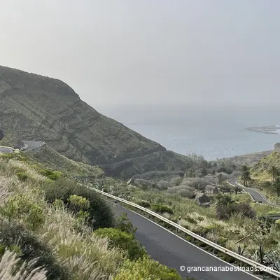
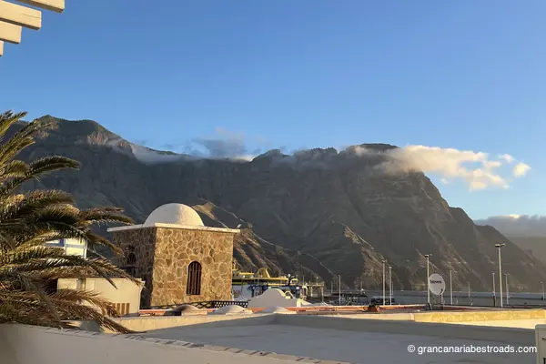
A compact working harbour, sheltered beneath imposing dark cliffs, with fish restaurants lining the quay, fishing boats still landing their catch, and a ferry terminal connecting **Gran Canaria** to **Tenerife** in just over an hour. The whitewashed village is genuinely lived-in — no hotel towers, no tourist infrastructure. What remains of the **Dedo de Dios**, the volcanic rock pinnacle largely destroyed by Hurricane Delta in 2005, is still visible from the harbour wall. The harbour of **Puerto de las Nieves** — a short descent from the town — offers a row of fish restaurants with open-air terraces. A typical dish is grilled parrotfish, and it's definitely worth trying here. A traditional Canarian windmill stands as a reminder of the area's agricultural past. A few minutes are enough to see it all, but for the atmosphere — the cliffs at your back, the Atlantic before you, the boats in between — it's worth lingering and stopping for lunch or dinner. Easy to reach with a short descent from the **GC-2** from Agaete. The **GC-200** sets off directly from the town, a spectacular road that leads to the notorious **Mirador del Balcón**.
Agaete
Agaete's strengths are its harbour, its valley, and its position as the gateway to the coastal road **GC-200**. Inland, the Valle de Agaete opens into a sheltered microclimate of citrus, avocado, and coffee plantations — one of the very few coffee-producing valleys in Europe, and the road that runs through it is lush and scenic **GC-231**. The Necrópolis del Maipés on the hills above the village is a pre-Hispanic burial site well worth a short detour. The Bajada de la Rama, held every August, is one of the most evocative and well-attended traditional events on the island. A good plan for visitors is to arrive in the late morning, which lets you stroll through the town and then along the pier, eat on the seafront, and still have the afternoon light during the climb up into the mountains. The **GC-220** rises spectacularly through the rock face in the Tamadaba Natural Park. Narrow and technical in places, it surprises you now and then with sudden Atlantic vistas. This road alone justifies adding Agaete to your itinerary.
Santa Lucía
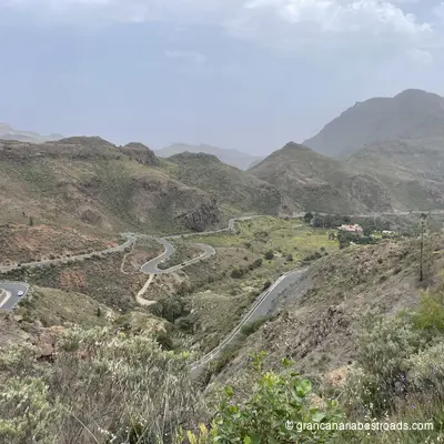
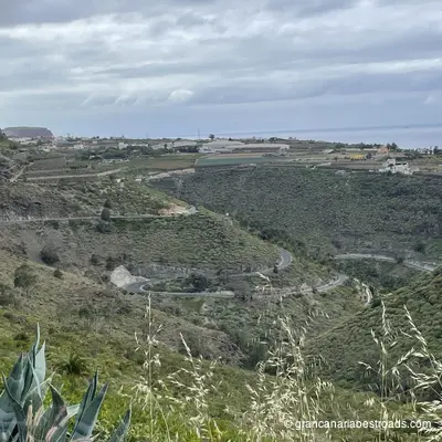
The traditional hillside village of **Santa Lucía de Tirajana** sits in the mid-altitude farming belt, with a quiet, rural character far removed from the coastal sprawl that spreads out lower down. The church of **Santa Lucía** presides over the village square. The surrounding landscape of deep ravines and terraced slopes is home to the archaeological site of **Las Fortalezas**, where ancient cave settlements of the aboriginal Canarians have been uncovered. **Roque Aguayro** lies nearby. The village is a natural stop on the southern mountain circuit: calm, authentic, genuinely different from the coast. A coffee on the square and the views over the **Barranco de Tirajana** are the main reward. Simple and honest. The road climbing from the coastal plain through the **Barranco de Tirajana** up to Santa Lucía, the **GC-65**, is extraordinary: canyon walls, flowering terraces and deserted hairpins. The shift from coastal chaos to mountain silence happens within minutes of leaving the lowlands behind. Best combined with the **Mirador de La Orilla**, just above.
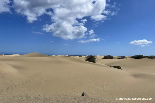
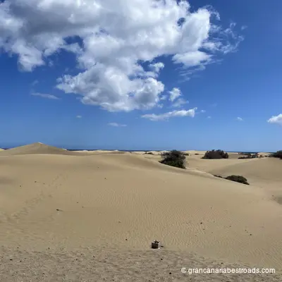
Mirador de Las Dunas
It is probably the most visited tourist attraction on **Gran Canaria**: an elevated viewpoint over the dunes of **Maspalomas**, around 400 hectares of shifting golden sand at the southernmost tip of the island, one of the few true desert ecosystems in Europe. From the **Mirador de Las Dunas** the whole expanse is visible: rhythmic crests and hollows, the morning light tinting the sand gold, the blue Atlantic marking the southern horizon, and the Maspalomas lighthouse rounding out the scene. The reserve also includes a freshwater lagoon, a palm grove, and a band of coastal scrub. The dunes themselves can be entered on foot from several access points — venturing in reveals a landscape of surprising silence and vastness. The nearby lighthouse area has cafes and facilities. The lagoon is a haven for migratory birds, particularly in autumn and spring. It is a must-stop for any itinerary in the south of the island.
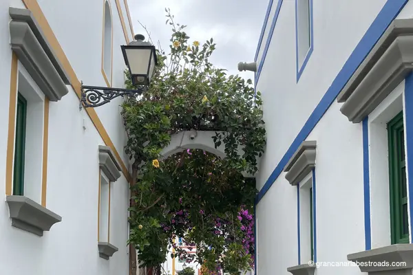
Puerto de Mogan
The most pleasant port town on the south-western coast — built to a human scale rather than that of tourist infrastructure. **Puerto de Mogan** is characterised by whitewashed houses draped in bougainvillea, a working fishing harbour that shares its space with small yachts and dive boats, a small sheltered beach and small canals with arched bridges. On Friday mornings a market fills the streets with local produce and crafts. Twenty minutes is enough to walk from one end to the other and see the whole marina. The beach is among the cleanest and most sheltered on the southern coast. The town has cafés, shops and numerous restaurants. An ideal arrival or turnaround point if you're exploring the South of **Gran Canaria**, Puerto de Mogán is the place to stop, eat well and appreciate that even one of the most touristy corners of the island still keeps a community at its heart.
Tufia
A tiny coastal hamlet of pre-Hispanic origin with a modest black-sand beach sheltered from the trade winds, unusually calm for the eastern coast. The volcanic headland above hides a complex of rock-cut openings and ancient stone structures that make up a Protected Cultural Heritage Site. The natural pools at the foot of the cliffs and the ruins visible on the headland give the cove an intimate, layered character, very different from the developed beaches further south. **Tufia** is genuinely peaceful and free of commercialization — one of those unexpected encounters that define the best days on the bike. There are no services; the hamlet is tiny. Climb up toward the headland to take in the views over the cove and the coastline stretching north and south. The endemic plants on the protected fossil dunes around the site are worth a closer look. Just off the coastal road south of **Las Palmas**. The eastern coastal strip isn't the island's most spectacular stretch, but **Tufia** itself — an authentic hamlet with ancient roots and a headland with a wild feel — is exactly the kind of place you'd miss by sticking to the main roads, and one that's well worth a visit.
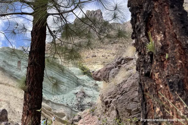
Los Azulejos de Veneguera
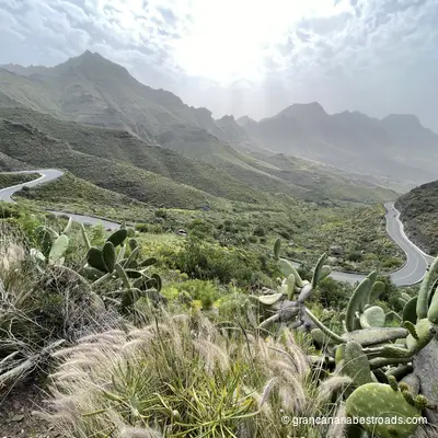
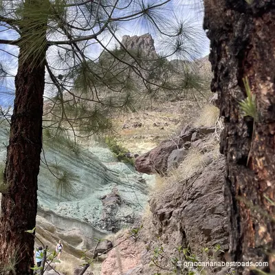
The extraordinary palette of colours is the reason it is famous: greens, blues, ochres, purples and reds painted onto a sheer rock wall deep within the **Barranco de Veneguera** — the result of mineral deposits in the ancient volcanic rock. There is no formal tourist infrastructure, just a pull-in area and the silence of the ravine, which is exactly its charm. The approach road through the valley is scenic and peaceful, with progressive views as the coast drops away behind you. The rock walls are best seen in morning or afternoon light, when the colours are most vivid against the surrounding dark basalt. No crowds, no entrance tickets, no facilities: if you want to visit **Los Azulejos** on foot, remember to bring your own water. The road through the **Veneguera** valley is narrow but well surfaced, with tight but very enjoyable hairpins for those seeking the pleasure of the ride. It lies within the **Parque Rural del Nublo**, so the surrounding terrain is wild and largely untouched. Combine it with a loop starting from **Puerto de Mogán** and continuing along the coast to **La Aldea** for a complete tour of the south-western part of **Gran Canaria**.
Playa de La Aldea
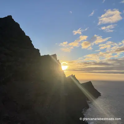
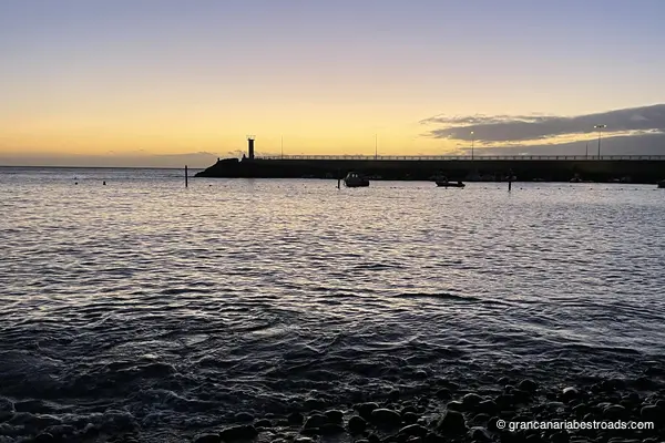
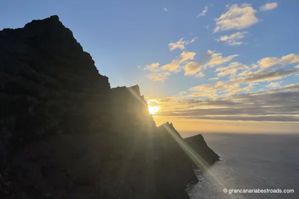
**La Aldea de San Nicolás** is the most remote community on **Gran Canaria**, isolated by the mountain ranges that give it a character entirely its own. The beach is dark sand, wild and undeveloped — nothing like the tourist beaches of the south. There are no hotels, no umbrellas for hire. The **Cactualdea** cactus garden lies nearby and is well worth a visit. The **Fiesta del Charco** on September 11th sees the villagers wade into the local lagoon to catch fish with their bare hands — a remarkably local tradition. The town is authentic and uncommercialized: eat simply, watch the ocean from a shore where the horizon is open, and take in the scale of the cliffs that ring the valley. The local restaurants serve typical island food, honest and genuine. **La Aldea** is the reward waiting at the end of one of the island's most extraordinary roads, the **GC-200**, whether you arrive along the spectacular coastal cliffs from Agaete or descend from the mountainous interior. The sunset "on the road" heading back toward Las Palmas is one of the most thrilling things for anyone who loves to ride — and not only them.
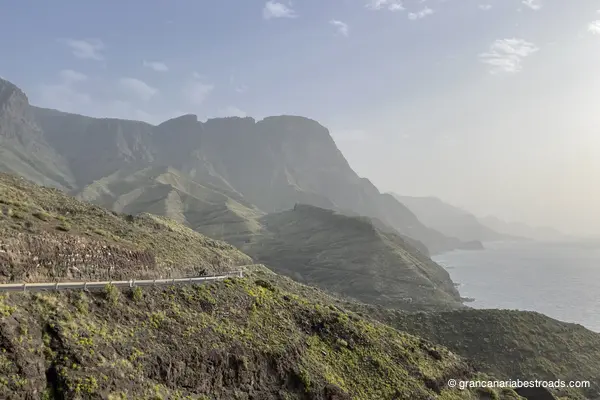
Mirador del Balcón
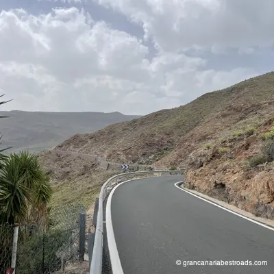
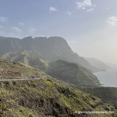
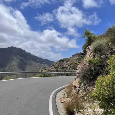
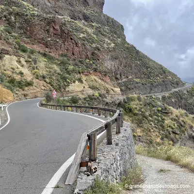
The glass-floored walkway of the **Mirador del Balcón** juts out beyond the edge of the cliff, letting you look straight down several hundred metres to the Atlantic. The recent renovation added information panels and improved access, while maintaining the view it has always offered: one of the most vertiginous and extraordinary on any island road in Europe. Several birds nest in the rock face and can often be watched as they hunt. The **GC-200** road that brings you here is as much of an objective as the viewpoint itself: this road clings to the edge of the cliff for kilometre after kilometre with nothing but ocean on one side and rock on the other. Traffic is light, the road surface quality is good, and the rhythm of the curves is relentless in the best sense of the word. The stop is quick and accessible; there is no need to walk to reach it.
Mirador de La Orilla
The Mirador de La Orilla gives you the full scale of the Barranco de Tirajana: a broad, flat valley floor flanked by walls that rise several hundred metres, with the characteristic flat-topped formations of the eroded caldera of **Gran Canaria** visible in every direction. The villages of **Santa Lucía** and **Agüimes** can be seen in the middle distance, surrounded by palm groves and terraced farmland. The contrast between the bare rock walls and the cultivated valley floor is sharp and striking. The roads that cross Tirajana and lead up here, the **GC-65** and **GC-60**, are among the most technically engaging on the island: sinuous descents, tight hairpins alternating with long stretches that let you read the road ahead. The mirador sits at the side of the road, with a small parking area, just a stone's throw from the town centre. It's an excellent candidate for a lunch or refreshment break during your itineraries.
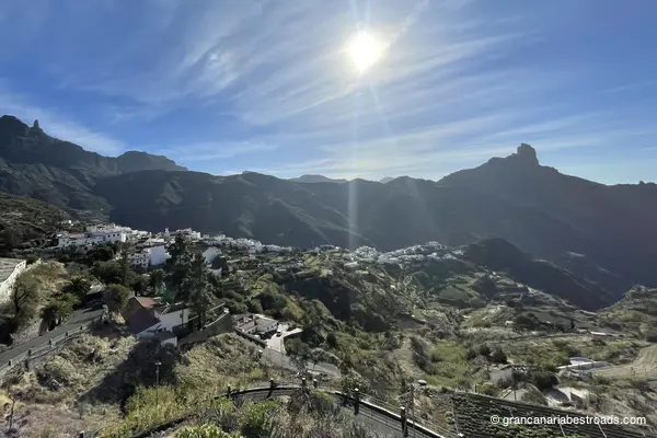
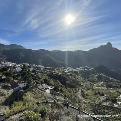
Tejeda
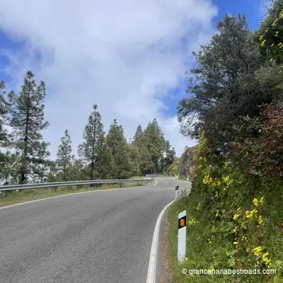
**Tejeda** is the beating heart of the most beautiful roads on **Gran Canaria**. The village sits at around 1,050 metres in the ancient caldera, surrounded by almond orchards that burst into pink and white blossom every February. The **Fiesta del Almendro en Flor** transforms the valley for the whole weekend. The village square is small, authentic and well equipped: at any time of year the local craft shops sell marzipan, honey and almond products, and there are cafés for a stop with a view over the caldera. **Roque Nublo** and **Roque Bentayga** are both visible from the surrounding roads. The **Parador** at **Cruz de Tejeda**, a few kilometres above the village, offers a bar and eatery with one of the finest panoramas on the island. The local almond sweets are among the best on Gran Canaria: well worth buying. From whichever direction you come, **Tejeda** is probably the high point of the route: from **Maspalomas** to the south, from **Agaete** to the north-west or from **Las Palmas** to the north-east, the roads serve up spectacular climbing sequences of consistent quality. The village is the natural midpoint of any serious loop through the interior, so plan your route to pass through it rather than around it.
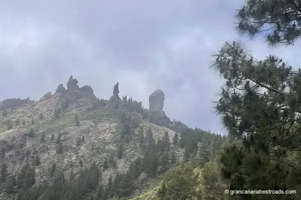
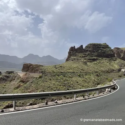
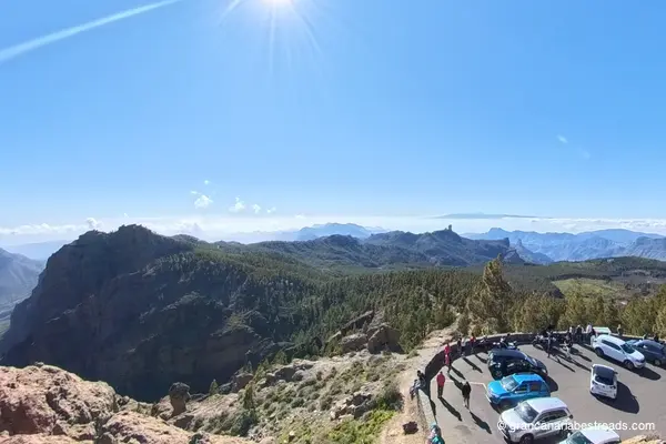
Roque Nublo
**Roque Nublo** is the most iconic landmark of **Gran Canaria**: an 80-metre-tall volcanic monolith standing at 1,813 metres, with its smaller companion El **Fraile** on a wind-swept plateau. The view from the top of the approach trail embraces the entire **Tejeda** caldera, all the way to the coast, and reaches the **Teide **on a clear day. The approach trail from the road takes about 45 minutes on foot and is well maintained, gaining elevation among volcanic boulders and scattered pines. The plateau around the base of the monolith is almost barren, with a sparse forest all around. There are no facilities at the trailhead. The roads climbing from Tejeda to the start of the Roque Nublo trail are among the finest in the Canary Islands: narrow, endlessly winding, with sudden open panoramas and little traffic. The hike rewards the ride, and the ride rewards the hike!!
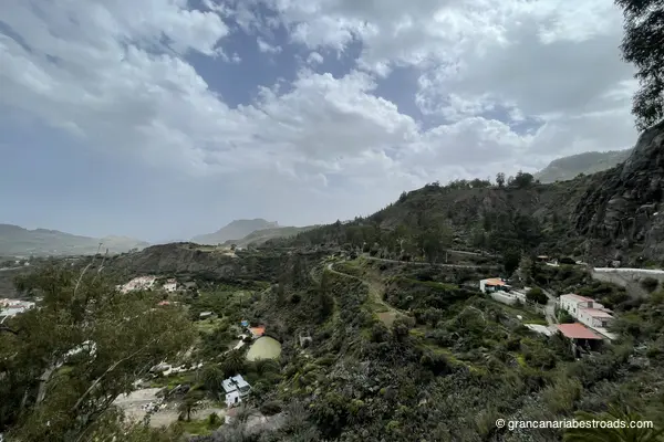
Moya
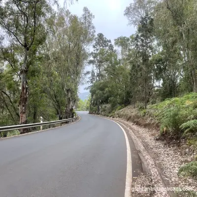
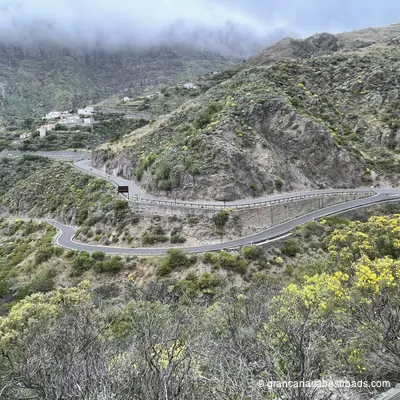
A quiet town in the north with two things worth your time: the laurisilva of Los Tilos de Moya in the barranco below, and a genuinely local character that makes it an excellent coffee stop before heading into the central mountains. It is the birthplace of the Canarian poet Tomás Morales, whose family home is now a museum, and that gives the town a cultural dimension all its own. The church of the Virgen de la Candelaria and the view from the square over the deep green barrancos are simple pleasures. The access road that runs through Los Tilos, the **GC-700**, winds through some of the most lush and shady terrain on the island, a total contrast to the arid south. The forest is the main attraction here: 90 hectares of ancient laurisilva, a living relic, best explored on foot along the barranco trails. Moya is a rewarding detour from the coastal corridor of the **GC-2**. The village is quiet, genuine and unhurried. The road it sits on, the **GC-75**, is arguably among the most beautiful on the island and certainly among my favourites.
Artenara
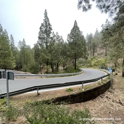
Artenara repays the time spent getting there with one of the most beautiful views in the entire Canary archipelago. From the rim of the **caldera** at 1,270 metres, Roque Nublo rises in the distance, and on clear days you can see the cone of the Teide and the island of Tenerife on the horizon. The village itself is quiet and authentic — cave houses carved into the volcanic tuff, narrow alleys, and a handful of local restaurants serving Canarian cuisine and a goat cheese that is highly renowned and the winner of several contests. Don't miss the Chapel of the Virgen de la Cuevita, a small church set into a natural cave at the edge of the caldera, with the ravine opening up beneath your feet. The nearby Risco Caído archaeological complex is a **UNESCO World Heritage** site. Also very distinctive is the restaurant **Cueva Del Molino**, where you dine inside the rock: an experience that alone is worth the visit. Every road leading up to Artenara is a true driving pleasure: long sequences of hairpin bends among pines and eucalyptus with little traffic and open panoramas. The **GC-220** from Agaete, the **GC-210** from Tejeda and the **GC-21** straight from Las Palmas are all exceptional. Temperatures at altitude are noticeably cooler than on the coast — a welcome change on hot days.
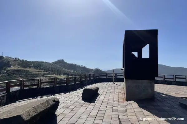
Mirador astronómico de Pinos
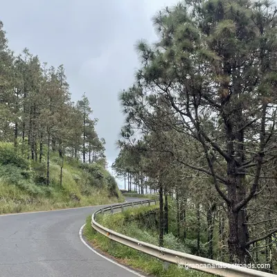
Built specifically for astronomical observation at around 1,400 metres of elevation, the **Mirador Astronómico de Pinos** is equipped with orientation panels and a sheltered viewing platform that minimises light pollution. On clear nights the Milky Way is extraordinary — the altitude, the clean Atlantic air, and the distance from the coastal resort lights make this one of the best stargazing spots on **Gran Canaria**. By day, the views over the pine canopy down to the ocean are exceptional, with **Tenerife** and **Teide** visible on the horizon. The surrounding **Tamadaba** pine forest is fragrant and atmospheric, and the walk around the site is rewarding even without a telescope. Plan this as a late-afternoon stop: linger until sunset, when the temperature drops, and stay for the stars before descending towards the coast. The road through the **Tamadaba** forest has tight bends, fresh air, and sudden openings with coastal panoramas. One of the few roads with excellent driving pleasure in both directions: find a way to include this stop on your travels.
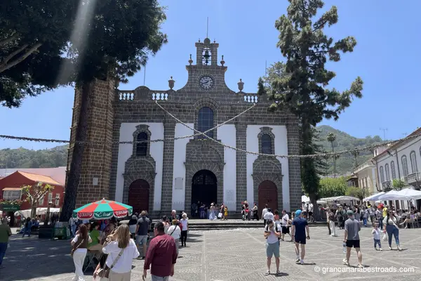
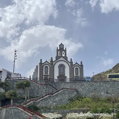
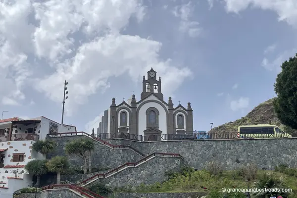
Basílica de la Virgen del Pino
It is one of the most religiously important churches in the Canary Islands. The **Basílica de Nuestra Señora del Pino** stands in the heart of Teror's cobbled old town. The venerated image of the Virgin is kept in a silver canopy in the Camarín — a treasure chamber holding centuries of devotional gifts, jewels, ex-votos and the **Green Cross** carved from the wood of the original pine. The sculptural works inside by José Luján Pérez, the leading island artist of the 18th century, are utterly captivating and well worth a visit. The basilica is the centerpiece of a town that is one of the finest examples of traditional Canarian architecture — whitewashed facades and intricately carved wooden balconies line the main streets around the square. On Sunday mornings a market fills the square with local cheeses, mojo sauces and traditional produce among the best on the island.
Mirador De La Atalaya de Artenara
The finest view from Artenara — and Artenara has several remarkable ones. From the edge of the village at 1,270 metres, the great caldera opens up before you: Roque Nublo rises in the foreground, Roque Bentayga off to one side, and on clear days the snow-capped cone of Teide on Tenerife appears on the horizon. Every road up to Artenara is a genuine riding pleasure: long sequences of hairpins through pine and eucalyptus with little traffic and wide-open views. Plan your descent along a different route, towards the Tamadaba forest or Agaete, rather than doubling back the way you came: you'll never be disappointed!
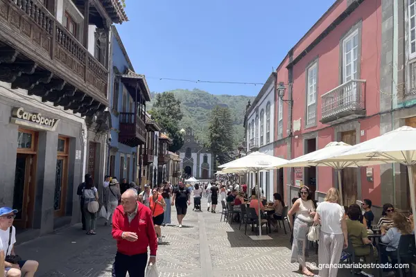
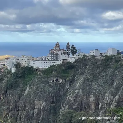
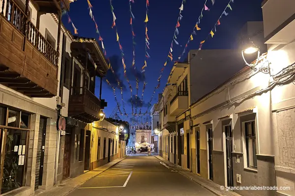
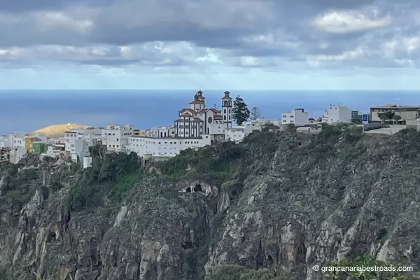
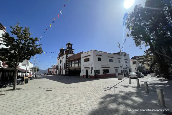
Teror
The historic centre of **Teror** is one of the finest examples of traditional Canarian architecture on any of the islands. The **Calle Real de la Plaza** is lined with whitewashed facades and richly carved wooden balconies, each one different from the next, which together form one of the most photographed urban views on **Gran Canaria**. The **Basílica de Nuestra Señora del Pino**, the most important church on **Gran Canaria**, dominates the square with its warm yellow cantería facade and its Portuguese Gothic-style bell tower. Inside the basilica, important sculptural works by José Luján Pérez and the treasure room with centuries of votive offerings are absolutely outstanding. On Sunday mornings a market fills the plaza with local cheeses, mojo sauces and traditional products — among the best on the island. The mineral water from **Teror** is sold everywhere on the island; it is genuinely good. The town feels completely separate from the capital despite the short distance. You reach it through hills cloaked in pine forest along the **GC-21** or the **GC-43**. You can easily park near the town centre. Allow at least an hour: the basilica, the historic streets and a coffee on the square make this the most rewarding cultural stop among the towns of northern Gran Canaria.
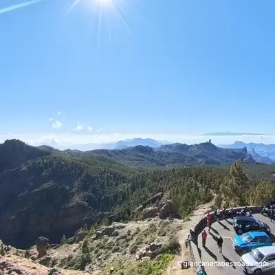
Pico de las Nieves
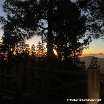
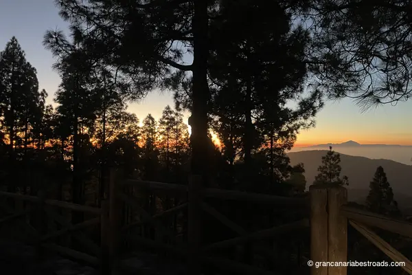
At 1,949 meters, **Pico de las Nieves** is the highest point of Gran Canaria and offers the most complete panorama of the island. On a clear day the entire island unfolds at your feet: green northern valleys, deep ochre erosion gullies to the south, the desert coast of **Maspalomas** and the interior of the caldera, while **Tenerife**, **La Palma** and **El Hierro** float on the horizon. The summit area is surrounded by fragrant Canary pine forests. A military telecommunications installation sits right on the peak, but the surrounding viewpoints are fully accessible. The road climbing up passes through the **Pilancones** pine forest and the cumbre plateau — the wide, elevated curves among pines and open heath are among the finest drives on the island. The air is noticeably cooler and cleaner at altitude, which makes this an excellent midday stop when it's hot. Park and enjoy the view. The summit is the geographic heart of the island, and from here roads set off in every direction: toward **Tejeda**, **Roque Nublo** or down to **Maspalomas**. It's truly easy, and almost obligatory, to slot **Pico de las Nieves** in as the final stage of your journey, to enjoy an unforgettable sunset!
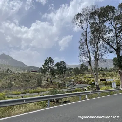
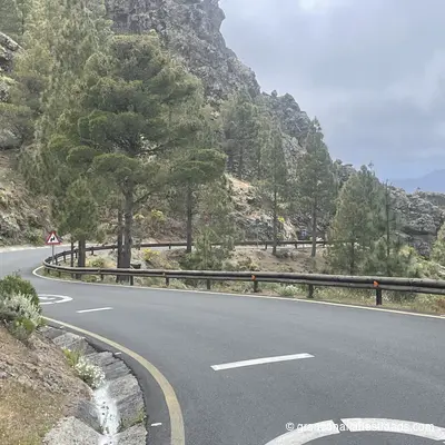
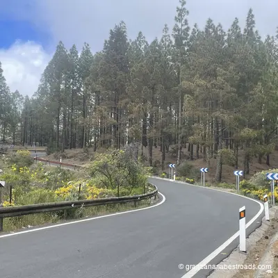
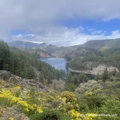
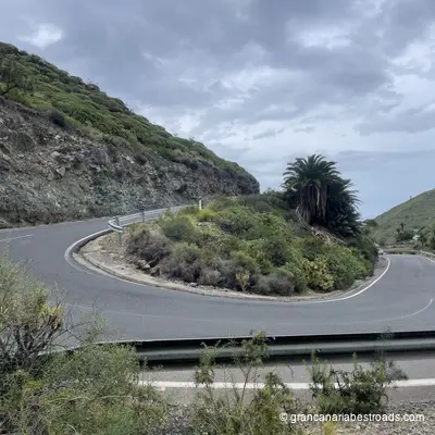
Gallery