Western Mountains
Itinerary Scores
Description
This itinerary will take you to explore the least touristy part of Gran Canaria, the North West. The first part of the day is dedicated to exploring the greenest and most lush area of the island, with roads winding through trees and forests that constantly change, all the way to the Tamadaba natural park. The second part is more unusual: small towns and hidden but fascinating roads, leading to a hidden and unexpected experience for those visiting the Canary Islands. Some walking is involved, but nothing demanding. Recommended only if purchased as part of a tour with other itineraries. Departure and arrival in Las Palmas.
What is included
- A PDF with a detailed map, a list of stops, timelines, a complete description of the route, points of interest, and recommended restaurants.
- A GPX track with all the stops, which can be used with your favorite app.
Included Points of Interest
Mirador de Agaete
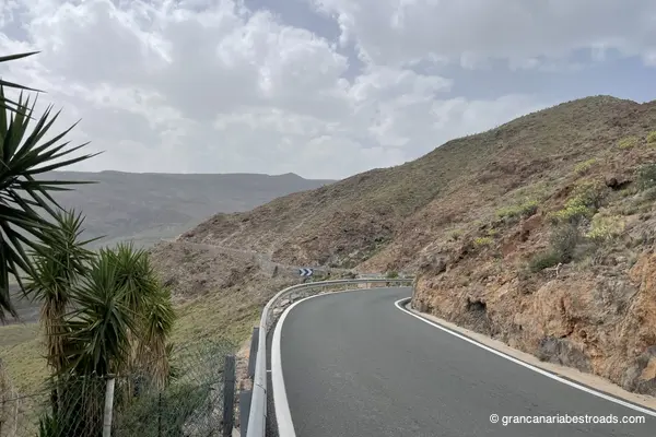
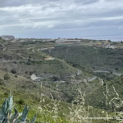
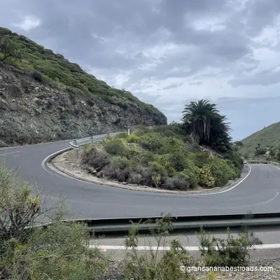
A coastal viewpoint over the spectacular meeting of volcanic cliffs and the Atlantic. The harbor of **Puerto de las Nieves** is visible below — a working port where the ferries to Tenerife set off. On clear days the cone of Teide dominates the horizon, rising above the clouds to the West. The mirador is small and quick to visit — right on the main road, no hike required. It pairs naturally with a stop at Puerto de las Nieves just a little further down. An almost effortless addition to any route for those coming to visit Agaete. The **GC-231** road that leads here is a touch narrow, but fun and with sea views: the mirador gives you a moment to take in the panorama of the cliffs before dropping down to the port.
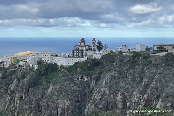
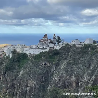
Artenara
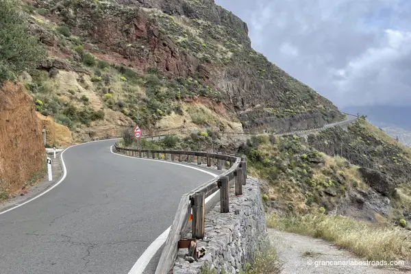
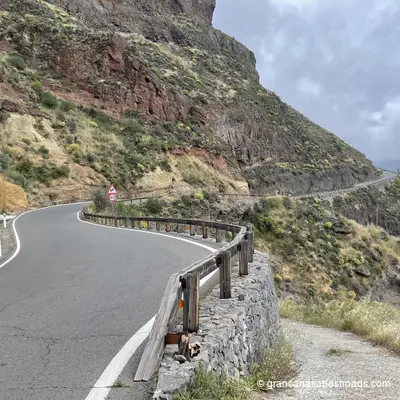
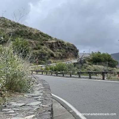
Artenara repays the time spent getting there with one of the most beautiful views in the entire Canary archipelago. From the rim of the **caldera** at 1,270 metres, Roque Nublo rises in the distance, and on clear days you can see the cone of the Teide and the island of Tenerife on the horizon. The village itself is quiet and authentic — cave houses carved into the volcanic tuff, narrow alleys, and a handful of local restaurants serving Canarian cuisine and a goat cheese that is highly renowned and the winner of several contests. Don't miss the Chapel of the Virgen de la Cuevita, a small church set into a natural cave at the edge of the caldera, with the ravine opening up beneath your feet. The nearby Risco Caído archaeological complex is a **UNESCO World Heritage** site. Also very distinctive is the restaurant **Cueva Del Molino**, where you dine inside the rock: an experience that alone is worth the visit. Every road leading up to Artenara is a true driving pleasure: long sequences of hairpin bends among pines and eucalyptus with little traffic and open panoramas. The **GC-220** from Agaete, the **GC-210** from Tejeda and the **GC-21** straight from Las Palmas are all exceptional. Temperatures at altitude are noticeably cooler than on the coast — a welcome change on hot days.
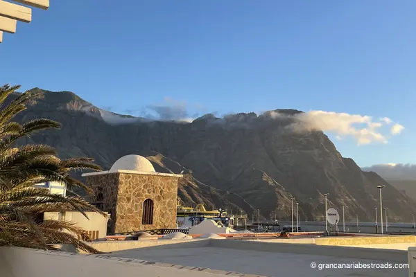
Puerto de las Nieves
A compact working harbour, sheltered beneath imposing dark cliffs, with fish restaurants lining the quay, fishing boats still landing their catch, and a ferry terminal connecting **Gran Canaria** to **Tenerife** in just over an hour. The whitewashed village is genuinely lived-in — no hotel towers, no tourist infrastructure. What remains of the **Dedo de Dios**, the volcanic rock pinnacle largely destroyed by Hurricane Delta in 2005, is still visible from the harbour wall. The harbour of **Puerto de las Nieves** — a short descent from the town — offers a row of fish restaurants with open-air terraces. A typical dish is grilled parrotfish, and it's definitely worth trying here. A traditional Canarian windmill stands as a reminder of the area's agricultural past. A few minutes are enough to see it all, but for the atmosphere — the cliffs at your back, the Atlantic before you, the boats in between — it's worth lingering and stopping for lunch or dinner. Easy to reach with a short descent from the **GC-2** from Agaete. The **GC-200** sets off directly from the town, a spectacular road that leads to the notorious **Mirador del Balcón**.

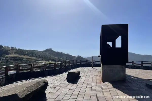
Mirador astronómico de Pinos
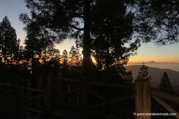
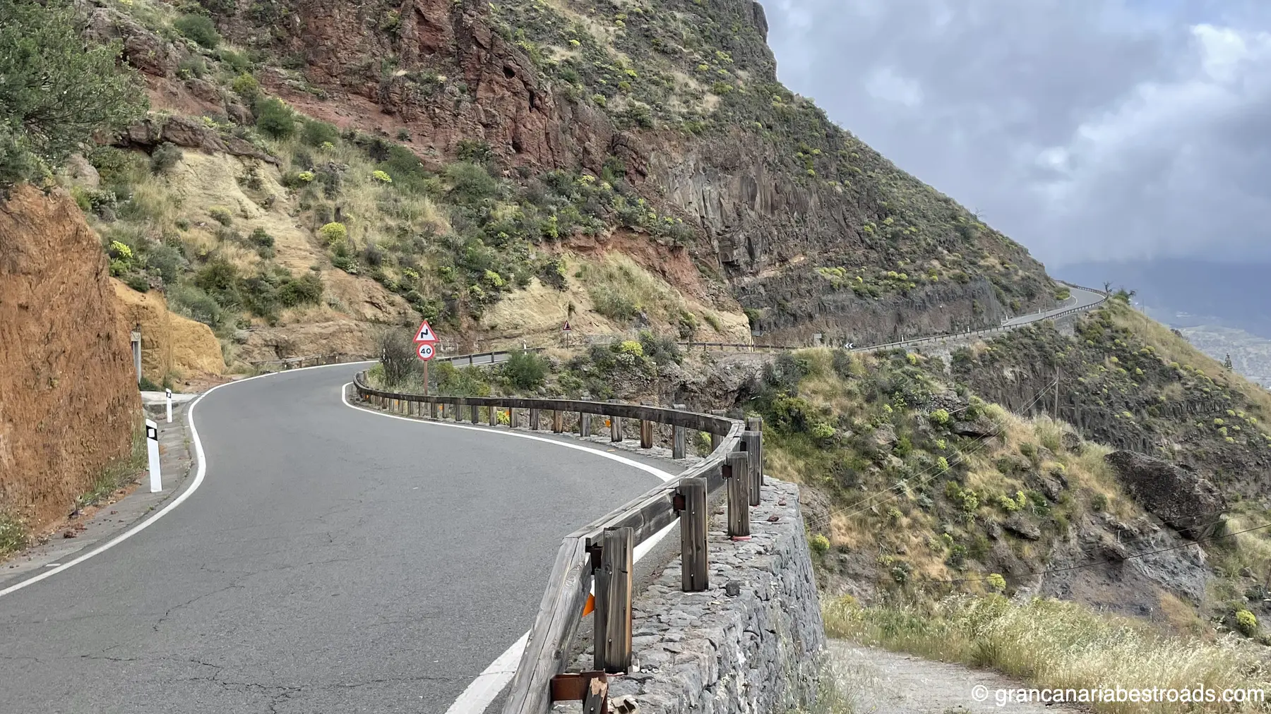
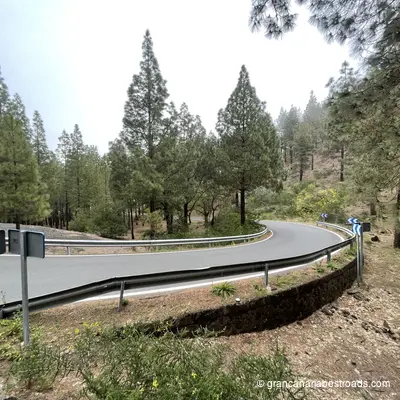
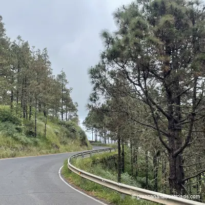
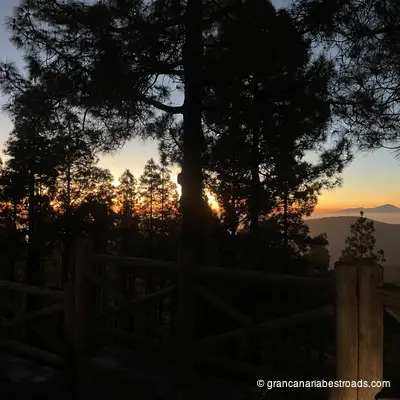
Built specifically for astronomical observation at around 1,400 metres of elevation, the **Mirador Astronómico de Pinos** is equipped with orientation panels and a sheltered viewing platform that minimises light pollution. On clear nights the Milky Way is extraordinary — the altitude, the clean Atlantic air, and the distance from the coastal resort lights make this one of the best stargazing spots on **Gran Canaria**. By day, the views over the pine canopy down to the ocean are exceptional, with **Tenerife** and **Teide** visible on the horizon. The surrounding **Tamadaba** pine forest is fragrant and atmospheric, and the walk around the site is rewarding even without a telescope. Plan this as a late-afternoon stop: linger until sunset, when the temperature drops, and stay for the stars before descending towards the coast. The road through the **Tamadaba** forest has tight bends, fresh air, and sudden openings with coastal panoramas. One of the few roads with excellent driving pleasure in both directions: find a way to include this stop on your travels.
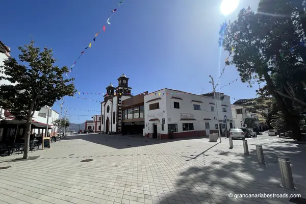
Moya
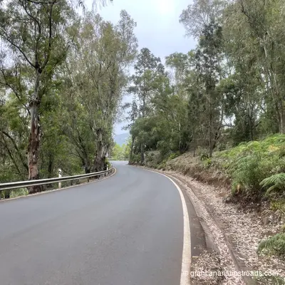
A quiet town in the north with two things worth your time: the laurisilva of Los Tilos de Moya in the barranco below, and a genuinely local character that makes it an excellent coffee stop before heading into the central mountains. It is the birthplace of the Canarian poet Tomás Morales, whose family home is now a museum, and that gives the town a cultural dimension all its own. The church of the Virgen de la Candelaria and the view from the square over the deep green barrancos are simple pleasures. The access road that runs through Los Tilos, the **GC-700**, winds through some of the most lush and shady terrain on the island, a total contrast to the arid south. The forest is the main attraction here: 90 hectares of ancient laurisilva, a living relic, best explored on foot along the barranco trails. Moya is a rewarding detour from the coastal corridor of the **GC-2**. The village is quiet, genuine and unhurried. The road it sits on, the **GC-75**, is arguably among the most beautiful on the island and certainly among my favourites.
Mirador De La Atalaya de Artenara
The finest view from Artenara — and Artenara has several remarkable ones. From the edge of the village at 1,270 metres, the great caldera opens up before you: Roque Nublo rises in the foreground, Roque Bentayga off to one side, and on clear days the snow-capped cone of Teide on Tenerife appears on the horizon. Every road up to Artenara is a genuine riding pleasure: long sequences of hairpins through pine and eucalyptus with little traffic and wide-open views. Plan your descent along a different route, towards the Tamadaba forest or Agaete, rather than doubling back the way you came: you'll never be disappointed!
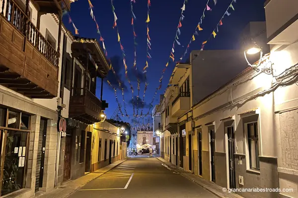
Agaete
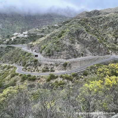
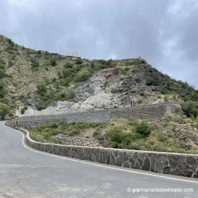
Agaete's strengths are its harbour, its valley, and its position as the gateway to the coastal road **GC-200**. Inland, the Valle de Agaete opens into a sheltered microclimate of citrus, avocado, and coffee plantations — one of the very few coffee-producing valleys in Europe, and the road that runs through it is lush and scenic **GC-231**. The Necrópolis del Maipés on the hills above the village is a pre-Hispanic burial site well worth a short detour. The Bajada de la Rama, held every August, is one of the most evocative and well-attended traditional events on the island. A good plan for visitors is to arrive in the late morning, which lets you stroll through the town and then along the pier, eat on the seafront, and still have the afternoon light during the climb up into the mountains. The **GC-220** rises spectacularly through the rock face in the Tamadaba Natural Park. Narrow and technical in places, it surprises you now and then with sudden Atlantic vistas. This road alone justifies adding Agaete to your itinerary.
Gallery
Journeys that include this itinerary
Get more value with a complete journey package