Eastern mountains
Itinerary Scores
Description
The goal of this itinerary is simple: to take the eastern half of Gran Canaria and ride all the best roads that characterize it. Pure and simple riding pleasure. There will still be the most famous peaks and a few towns to explore, and a sunset over the Maspalomas dunes. Don't worry if this itinerary doesn't always seem to take the shortest route: it has been studied, planned, and tested to show you all the best of this part of the island. Recommended only if purchased as part of a tour with other itineraries. Departure and arrival in Las Palmas.
What is included
- A PDF with a detailed map, a list of stops, timelines, a complete description of the route, points of interest, and recommended restaurants.
- A GPX track with all the stops, which can be used with your favorite app.
Included Points of Interest
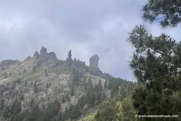
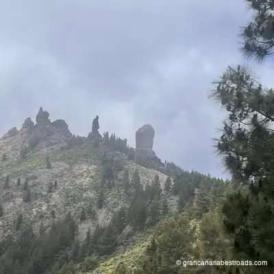
Roque Nublo
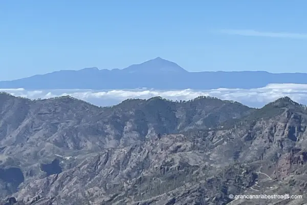
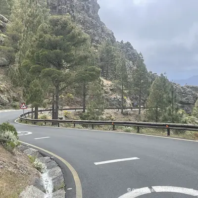
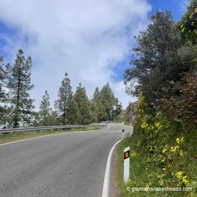
**Roque Nublo** is the most iconic landmark of **Gran Canaria**: an 80-metre-tall volcanic monolith standing at 1,813 metres, with its smaller companion El **Fraile** on a wind-swept plateau. The view from the top of the approach trail embraces the entire **Tejeda** caldera, all the way to the coast, and reaches the **Teide **on a clear day. The approach trail from the road takes about 45 minutes on foot and is well maintained, gaining elevation among volcanic boulders and scattered pines. The plateau around the base of the monolith is almost barren, with a sparse forest all around. There are no facilities at the trailhead. The roads climbing from Tejeda to the start of the Roque Nublo trail are among the finest in the Canary Islands: narrow, endlessly winding, with sudden open panoramas and little traffic. The hike rewards the ride, and the ride rewards the hike!!
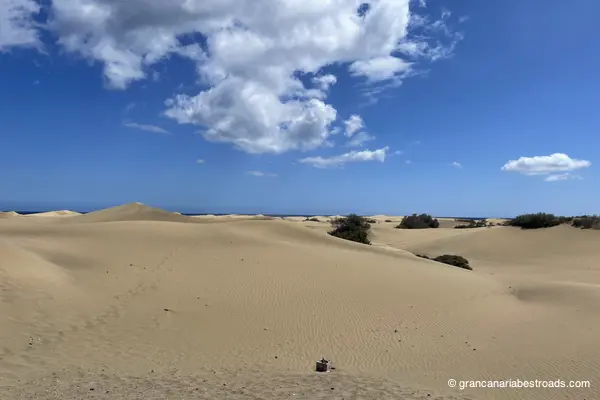
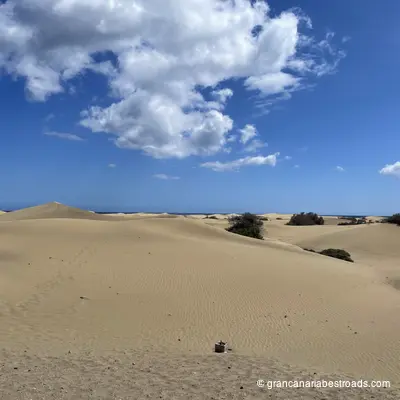
Mirador de Las Dunas
It is probably the most visited tourist attraction on **Gran Canaria**: an elevated viewpoint over the dunes of **Maspalomas**, around 400 hectares of shifting golden sand at the southernmost tip of the island, one of the few true desert ecosystems in Europe. From the **Mirador de Las Dunas** the whole expanse is visible: rhythmic crests and hollows, the morning light tinting the sand gold, the blue Atlantic marking the southern horizon, and the Maspalomas lighthouse rounding out the scene. The reserve also includes a freshwater lagoon, a palm grove, and a band of coastal scrub. The dunes themselves can be entered on foot from several access points — venturing in reveals a landscape of surprising silence and vastness. The nearby lighthouse area has cafes and facilities. The lagoon is a haven for migratory birds, particularly in autumn and spring. It is a must-stop for any itinerary in the south of the island.
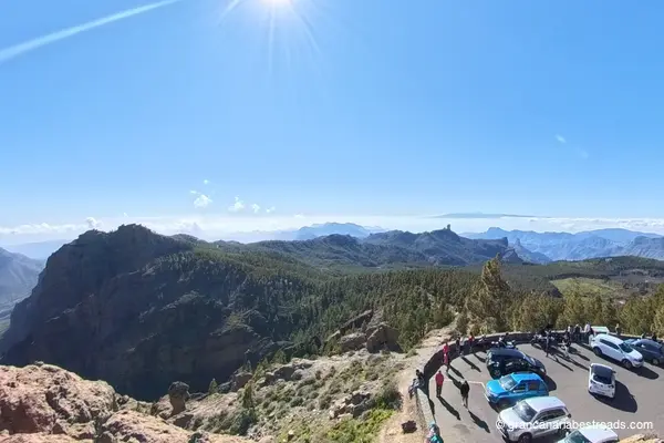
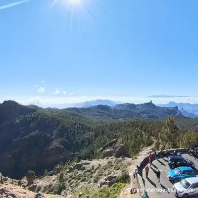
Pico de las Nieves
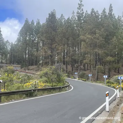
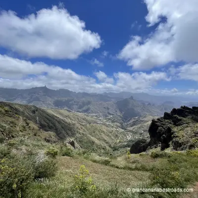
At 1,949 meters, **Pico de las Nieves** is the highest point of Gran Canaria and offers the most complete panorama of the island. On a clear day the entire island unfolds at your feet: green northern valleys, deep ochre erosion gullies to the south, the desert coast of **Maspalomas** and the interior of the caldera, while **Tenerife**, **La Palma** and **El Hierro** float on the horizon. The summit area is surrounded by fragrant Canary pine forests. A military telecommunications installation sits right on the peak, but the surrounding viewpoints are fully accessible. The road climbing up passes through the **Pilancones** pine forest and the cumbre plateau — the wide, elevated curves among pines and open heath are among the finest drives on the island. The air is noticeably cooler and cleaner at altitude, which makes this an excellent midday stop when it's hot. Park and enjoy the view. The summit is the geographic heart of the island, and from here roads set off in every direction: toward **Tejeda**, **Roque Nublo** or down to **Maspalomas**. It's truly easy, and almost obligatory, to slot **Pico de las Nieves** in as the final stage of your journey, to enjoy an unforgettable sunset!
Mirador de La Orilla
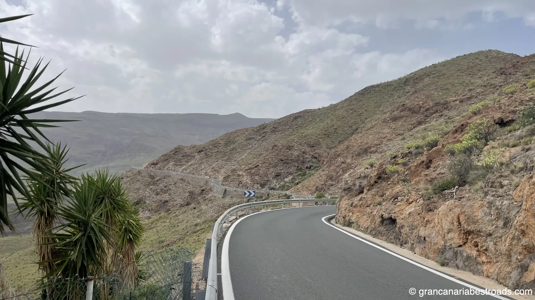
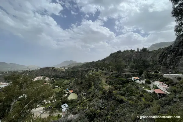
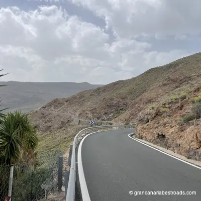
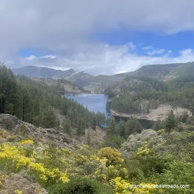
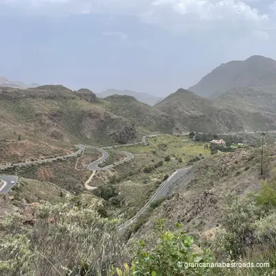
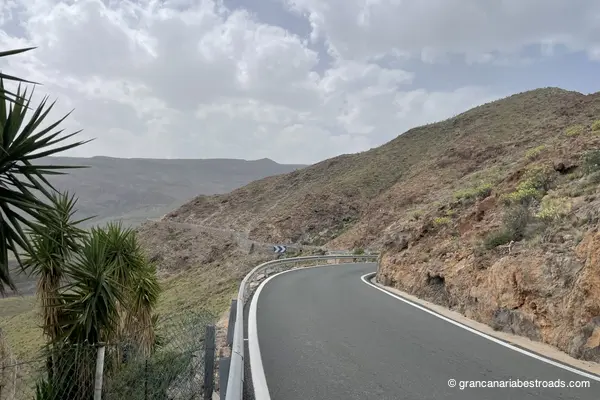
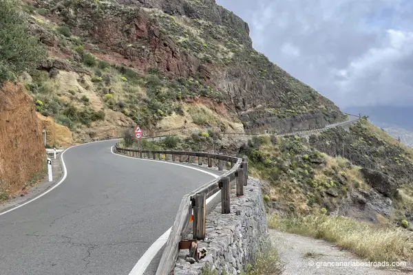
The Mirador de La Orilla gives you the full scale of the Barranco de Tirajana: a broad, flat valley floor flanked by walls that rise several hundred metres, with the characteristic flat-topped formations of the eroded caldera of **Gran Canaria** visible in every direction. The villages of **Santa Lucía** and **Agüimes** can be seen in the middle distance, surrounded by palm groves and terraced farmland. The contrast between the bare rock walls and the cultivated valley floor is sharp and striking. The roads that cross Tirajana and lead up here, the **GC-65** and **GC-60**, are among the most technically engaging on the island: sinuous descents, tight hairpins alternating with long stretches that let you read the road ahead. The mirador sits at the side of the road, with a small parking area, just a stone's throw from the town centre. It's an excellent candidate for a lunch or refreshment break during your itineraries.
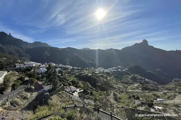
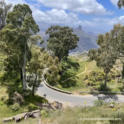
Tejeda
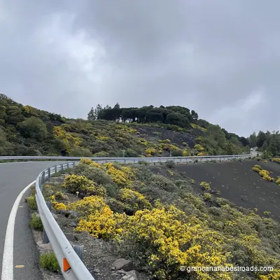
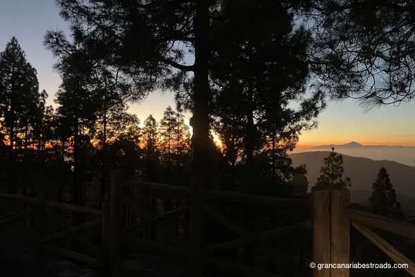
**Tejeda** is the beating heart of the most beautiful roads on **Gran Canaria**. The village sits at around 1,050 metres in the ancient caldera, surrounded by almond orchards that burst into pink and white blossom every February. The **Fiesta del Almendro en Flor** transforms the valley for the whole weekend. The village square is small, authentic and well equipped: at any time of year the local craft shops sell marzipan, honey and almond products, and there are cafés for a stop with a view over the caldera. **Roque Nublo** and **Roque Bentayga** are both visible from the surrounding roads. The **Parador** at **Cruz de Tejeda**, a few kilometres above the village, offers a bar and eatery with one of the finest panoramas on the island. The local almond sweets are among the best on Gran Canaria: well worth buying. From whichever direction you come, **Tejeda** is probably the high point of the route: from **Maspalomas** to the south, from **Agaete** to the north-west or from **Las Palmas** to the north-east, the roads serve up spectacular climbing sequences of consistent quality. The village is the natural midpoint of any serious loop through the interior, so plan your route to pass through it rather than around it.
Cruz de Tejeda
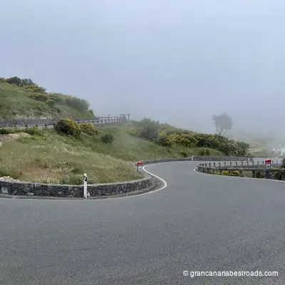
The geographic and, for some, emotional heart of **Gran Canaria**. At around 1,450 metres above sea level and perched on the rim of a caldera, **Cruz de Tejeda** sits at the crossroads of several of the island's mountain roads, all of them spectacular, with **Roque Nublo** rising up before you and the panorama opening out in every direction. The stone cross at its centre is surrounded by craft stalls selling almond-based products from the orchards below: every February the almonds blossom white and pink in one of the island's most celebrated natural events. The *Parador* at the mouth of the pass is an elegant traditional stone building where you can stop for a coffee or a meal with views over the caldera. Along the road you'll often find stalls selling almond sweets, honey and local products among the finest on the island. Cloud formations frequently wrap around the rim of the caldera, creating a dramatic, ever-changing light that is well worth waiting for. **Cruz de Tejeda** is the natural climax of any ride through the interior. The **GC-150** arrives both from the North, through a pine forest, and from the South, from **Pico de las Nieves**; the **GC-60** comes in from the West and climbs all the way from **Maspalomas**, passing through **Tejeda** with tight hairpins and dizzying drops, and the **GC-15** is the connecting point for all the roads climbing up from the East.
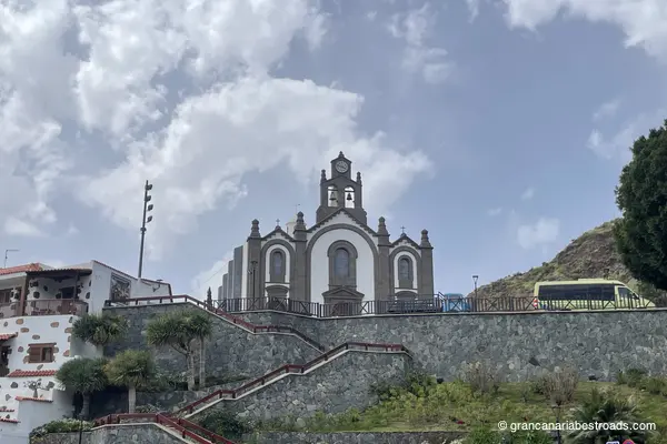
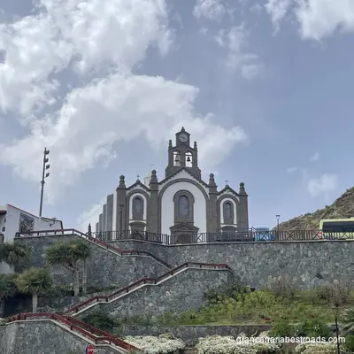
Santa Lucía
The traditional hillside village of **Santa Lucía de Tirajana** sits in the mid-altitude farming belt, with a quiet, rural character far removed from the coastal sprawl that spreads out lower down. The church of **Santa Lucía** presides over the village square. The surrounding landscape of deep ravines and terraced slopes is home to the archaeological site of **Las Fortalezas**, where ancient cave settlements of the aboriginal Canarians have been uncovered. **Roque Aguayro** lies nearby. The village is a natural stop on the southern mountain circuit: calm, authentic, genuinely different from the coast. A coffee on the square and the views over the **Barranco de Tirajana** are the main reward. Simple and honest. The road climbing from the coastal plain through the **Barranco de Tirajana** up to Santa Lucía, the **GC-65**, is extraordinary: canyon walls, flowering terraces and deserted hairpins. The shift from coastal chaos to mountain silence happens within minutes of leaving the lowlands behind. Best combined with the **Mirador de La Orilla**, just above.
Gallery
Journeys that include this itinerary
Get more value with a complete journey package
Gran Canaria Journey in 3 Days
A 3-day journey to discover every face of Gran Canaria, from the wild coast to the volcanic peaks and the most authentic villages on the island.
Included itineraries:
- Eastern mountains
- Cities and mountains of the north
- I want to go to the sea
Gran Canaria Journey in 4 Days
A 4-day journey to discover Gran Canaria, from the wild coast to the volcanic peaks, the most authentic villages, and the island's main natural park.
Included itineraries:
- Eastern mountains
- Western Mountains
- Cities and mountains of the north
- I want to go to the sea