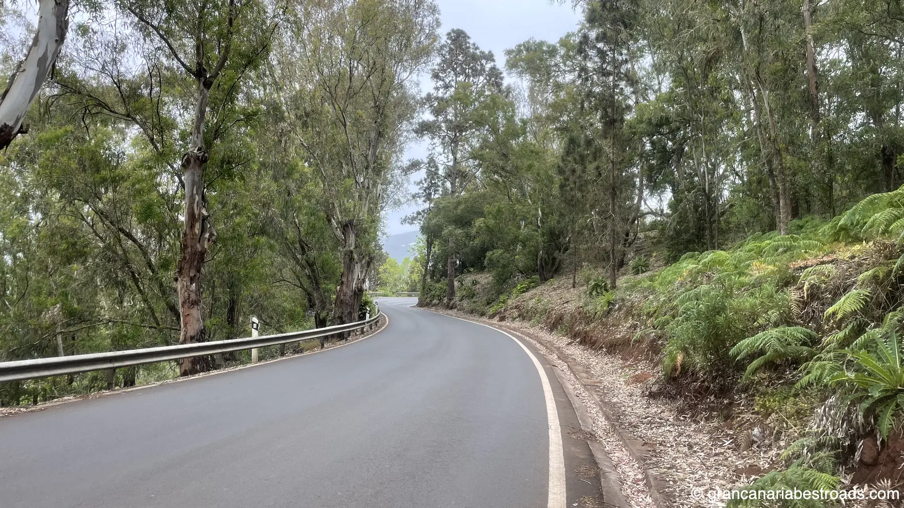
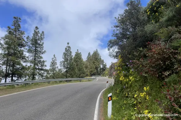
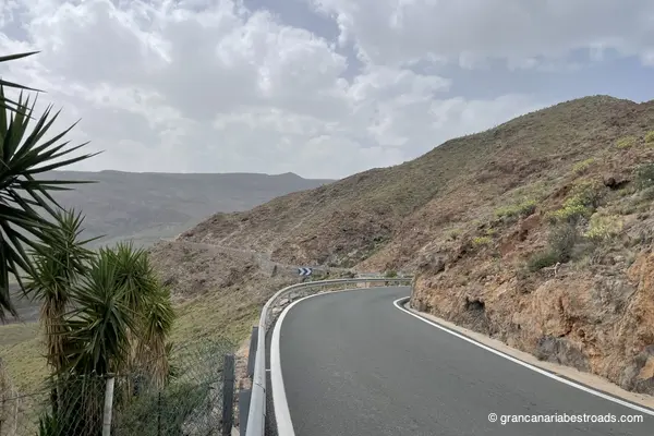
GC-21
Road Scores
Description
Included Points of Interest
Artenara
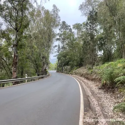
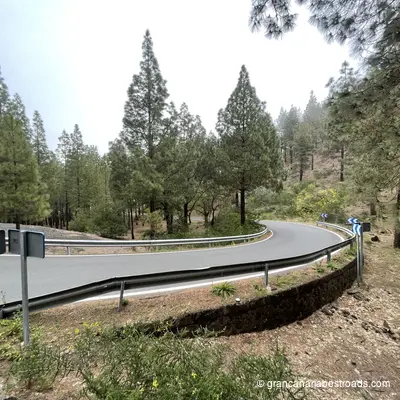
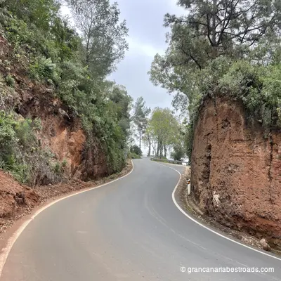
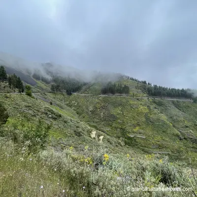
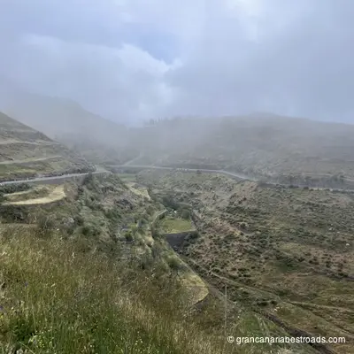
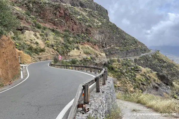
Artenara repays the time spent getting there with one of the most beautiful views in the entire Canary archipelago. From the rim of the **caldera** at 1,270 metres, Roque Nublo rises in the distance, and on clear days you can see the cone of the Teide and the island of Tenerife on the horizon. The village itself is quiet and authentic — cave houses carved into the volcanic tuff, narrow alleys, and a handful of local restaurants serving Canarian cuisine and a goat cheese that is highly renowned and the winner of several contests. Don't miss the Chapel of the Virgen de la Cuevita, a small church set into a natural cave at the edge of the caldera, with the ravine opening up beneath your feet. The nearby Risco Caído archaeological complex is a **UNESCO World Heritage** site. Also very distinctive is the restaurant **Cueva Del Molino**, where you dine inside the rock: an experience that alone is worth the visit. Every road leading up to Artenara is a true driving pleasure: long sequences of hairpin bends among pines and eucalyptus with little traffic and open panoramas. The **GC-220** from Agaete, the **GC-210** from Tejeda and the **GC-21** straight from Las Palmas are all exceptional. Temperatures at altitude are noticeably cooler than on the coast — a welcome change on hot days.

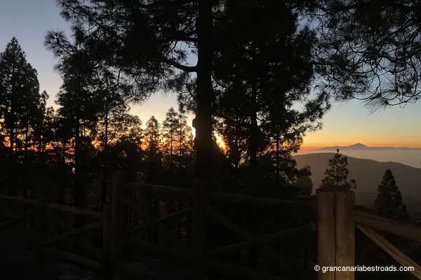
Mirador astronómico de Pinos
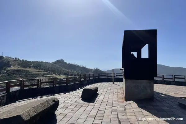
Built specifically for astronomical observation at around 1,400 metres of elevation, the **Mirador Astronómico de Pinos** is equipped with orientation panels and a sheltered viewing platform that minimises light pollution. On clear nights the Milky Way is extraordinary — the altitude, the clean Atlantic air, and the distance from the coastal resort lights make this one of the best stargazing spots on **Gran Canaria**. By day, the views over the pine canopy down to the ocean are exceptional, with **Tenerife** and **Teide** visible on the horizon. The surrounding **Tamadaba** pine forest is fragrant and atmospheric, and the walk around the site is rewarding even without a telescope. Plan this as a late-afternoon stop: linger until sunset, when the temperature drops, and stay for the stars before descending towards the coast. The road through the **Tamadaba** forest has tight bends, fresh air, and sudden openings with coastal panoramas. One of the few roads with excellent driving pleasure in both directions: find a way to include this stop on your travels.
Basílica de la Virgen del Pino
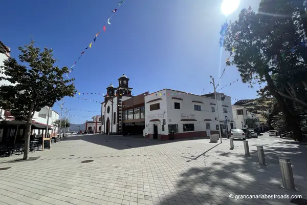
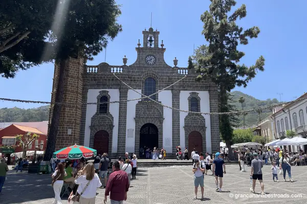
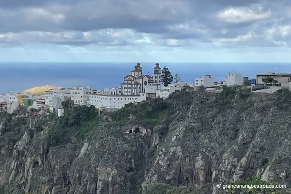
It is one of the most religiously important churches in the Canary Islands. The **Basílica de Nuestra Señora del Pino** stands in the heart of Teror's cobbled old town. The venerated image of the Virgin is kept in a silver canopy in the Camarín — a treasure chamber holding centuries of devotional gifts, jewels, ex-votos and the **Green Cross** carved from the wood of the original pine. The sculptural works inside by José Luján Pérez, the leading island artist of the 18th century, are utterly captivating and well worth a visit. The basilica is the centerpiece of a town that is one of the finest examples of traditional Canarian architecture — whitewashed facades and intricately carved wooden balconies line the main streets around the square. On Sunday mornings a market fills the square with local cheeses, mojo sauces and traditional produce among the best on the island.
Mirador De La Atalaya de Artenara
The finest view from Artenara — and Artenara has several remarkable ones. From the edge of the village at 1,270 metres, the great caldera opens up before you: Roque Nublo rises in the foreground, Roque Bentayga off to one side, and on clear days the snow-capped cone of Teide on Tenerife appears on the horizon. Every road up to Artenara is a genuine riding pleasure: long sequences of hairpins through pine and eucalyptus with little traffic and wide-open views. Plan your descent along a different route, towards the Tamadaba forest or Agaete, rather than doubling back the way you came: you'll never be disappointed!
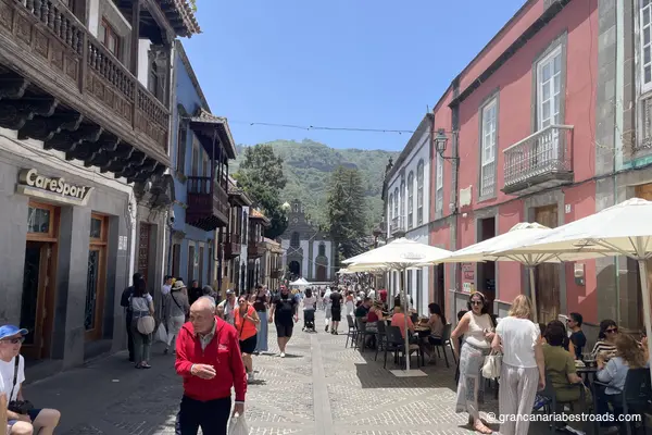
Teror
The historic centre of **Teror** is one of the finest examples of traditional Canarian architecture on any of the islands. The **Calle Real de la Plaza** is lined with whitewashed facades and richly carved wooden balconies, each one different from the next, which together form one of the most photographed urban views on **Gran Canaria**. The **Basílica de Nuestra Señora del Pino**, the most important church on **Gran Canaria**, dominates the square with its warm yellow cantería facade and its Portuguese Gothic-style bell tower. Inside the basilica, important sculptural works by José Luján Pérez and the treasure room with centuries of votive offerings are absolutely outstanding. On Sunday mornings a market fills the plaza with local cheeses, mojo sauces and traditional products — among the best on the island. The mineral water from **Teror** is sold everywhere on the island; it is genuinely good. The town feels completely separate from the capital despite the short distance. You reach it through hills cloaked in pine forest along the **GC-21** or the **GC-43**. You can easily park near the town centre. Allow at least an hour: the basilica, the historic streets and a coffee on the square make this the most rewarding cultural stop among the towns of northern Gran Canaria.
Gallery
Itineraries that include this road
Discover complete riding experiences featuring this road
The heart of Gran Canaria (balanced version)
Discover the peaks and towns at the heart of Gran Canaria, with the right mix of riding and exploration.
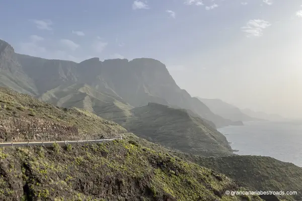
Western Mountains
Coasts, beaches, centuries-old pines and a mountain natural park that overlooks the ocean.
The heart of Gran Canaria (tourist version)
Discover the peaks and towns at the heart of Gran Canaria, prioritising the discovery of places and towns.
The heart of Gran Canaria (road version)
Discover the peaks and towns at the heart of Gran Canaria, prioritising the riding experience.
Cities and mountains of the north
An itinerary dedicated to the towns and roads of the North Eastern part of Gran Canaria, between history and nature.
Journeys that include this road
Complete journey packages featuring this road
Gran Canaria Journey in 2 Days (balanced version)
A two-day exploration of Gran Canaria combining the main coastal and mountain attractions. A balanced mix of riding and sightseeing.
Included itineraries:
- Grand sea itinerary
- The heart of Gran Canaria (balanced version)
Gran Canaria Journey in 2 Days (road version)
A two-day exploration of Gran Canaria combining the main coastal and mountain attractions, with a focus on riding pleasure.
Included itineraries:
- Grand sea itinerary
- The heart of Gran Canaria (road version)
Gran Canaria Journey in 4 Days
A 4-day journey to discover Gran Canaria, from the wild coast to the volcanic peaks, the most authentic villages, and the island's main natural park.
Included itineraries:
- Eastern mountains
- Western Mountains
- Cities and mountains of the north
- I want to go to the sea
Gran Canaria Journey in 3 Days
A 3-day journey to discover every face of Gran Canaria, from the wild coast to the volcanic peaks and the most authentic villages on the island.
Included itineraries:
- Eastern mountains
- Cities and mountains of the north
- I want to go to the sea
Gran Canaria Journey in 2 Days (tourist version)
A two-day exploration of Gran Canaria combining the main coastal and mountain attractions with the most characteristic Canarian towns.
Included itineraries:
- Grand sea itinerary
- The heart of Gran Canaria (tourist version)